Julkaisut ja raportit
Löydät hakupalvelusta kootusti kaikki GTK:n tuottamat julkaisut, GTK:n laatimat tai sille luovutetut arkistoraportit sekä kartat.
Hae julkaisuja
Tältä sivulta löydät keskitetysti ajantasaiset geologiset dokumentit sekä voit selata, ladata tai ostaa esimerkiksi paikkatietotuotteita. Rajapintapalveluiden avulla voit myös käyttää GTK:n aineistoja oman palvelusi pohjana maksutta.
Tämän sivuston palvelut on suunnattu geologian ammattilaisille – mikäli et ole asiantuntija, saatat löytää sinulle sopivammat palvelut Kansannäytetoiminta – sivuiltamme.
Hakku on porttisi kaikkeen GTK:n julkaisemaan materiaaliin. Hakusta voit hakea ja ladata geotietotuotteita aina 1800-luvulta saakka. Palvelusta löydät kätevästi mm. GTK:n julkaisuja, arkistoraportteja, karttoja, valokuvia sekä paikkatietotuotteita. Suurin osa tuotteista on selattavissa ja ladattavissa maksutta. Maksullisten tuotteiden tilaaminen onnistuu helposti Hakku-palvelun verkkokaupan kautta.
Siirry Hakku-palveluun
Löydät hakupalvelusta kootusti kaikki GTK:n tuottamat julkaisut, GTK:n laatimat tai sille luovutetut arkistoraportit sekä kartat.
Hae julkaisuja
Lataa ilmaiseksi tai osta geologian alan paikkatietotuotteita. Tuotteiden metatietojen avulla voit arvioida niiden soveltuvuutta omiin käyttötarpeisiisi.
Tutustu paikkatietotuotteisiinSelaa ja lataa maksutta geologiaan liittyviä valokuvia aina 1870-luvulta alkaen. Voit hakea valokuvia kuvan sisällön, kuvauspaikan tai kuvausajan mukaan.
Katsele valokuviaSelaa GTK:n vanhoja käsin piirrettyjä geologisia karttoja ja niihin liittyviä metatietoja vuosilta 1850-1970. Suuriresoluutioiset kuvat ovat kaikki ladattavissa maksutta jpeg- tai tiff-muodossa.
Selaa karttojaKarttapalveluista löydät suuren määrän havainto- ja mittaustietoa visuaalisessa muodossa. Aineistot on jaettu käyttötarkoituksen mukaisiin teemoihin kuten mineraaliesiintymiin, kallioperätutkimukseen ja turvemaiden kartoitukseen. Karttapalveluissa voit aktivoida haluamasi karttatasot, zoomata haluamaasi mittakaavaan ja klikata saadaksesi kohteesta lisätietoja.
Tutustu karttapalveluihin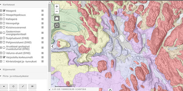
Maankamarasta löytyy laajasti tietoa Suomen maa- ja kallioperästä. Voit tarkastella samassa palvelussa dataa myös esimerkiksi MML:n kehutusta laserkeilausaineistosta.
Siirry Maankamaraan
Karttasovellus sisältää Suomen mineraaliesiintymät, kaivokset, kaivosrekisteridatan, geologiset ja geofysikaaliset kartat sekä havainto- ja mittausaineiston.
Käytä palvelua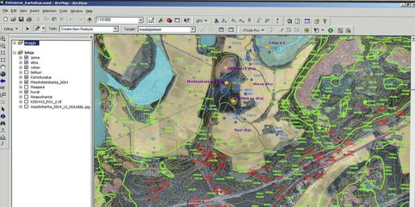
Usean eri tuottajan aineistosta koottu pohja-tutkimustietojen katselu- ja latauspalvelu auttaa selvittämään maaperän laadun ja rakenteen alueellisesti.
Selaa tutkimustietoja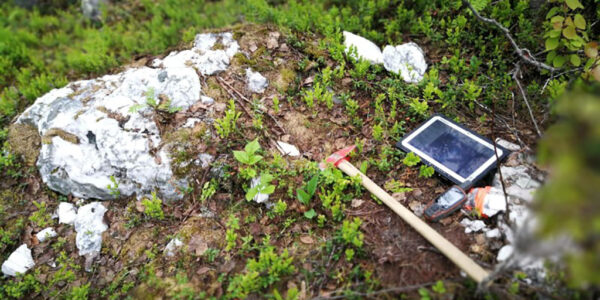
Täältä löydät Suomen rannikkoseudun happamien sulfaattimaiden sijainti- ja ominaisuustiedot.
Lisätietoa sulfaattimaista
Haluatko selvittää, missä on pohjavesialueita? Lähteestä saat tutkituilta pohjavesialueilta mallinnetut kallionpinnan ja pohjavesipinnan korkeustasot sekä tietoa mm. pohjavesialueiden maakerrosten paksuudesta.
Tutustu pohjavesialueisiin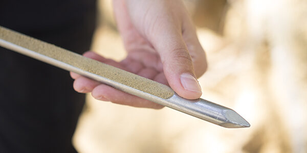
Tapir näyttää maaperän luontaiset taustapitoisuudet tietyllä alueella. Taustapitoisuustietoja tarvitaan esimerkiksi maaperän pilaantumisen ja puhdistustarpeen arvioinnissa.
Lisätietoa taustapitoisuuksista
Rajapintapalvelu on tekninen käyttöyhteys GTK:n palvelimelle. Rajapintapalveluiden avulla voit helposti hyödyntää valmiiksi kerättyä dataa oman tietokantasi lisänä tai pohjana. Palveluiden käyttö on maksutonta eikä edellytä kirjautumista, mutta käyttäjän on hyväksyttävä käyttöehdot ja huomioitava, että karttatasosta riippuen käyttöoikeus on joko rajoitettu tai avoin jatkokäyttöoikeus.
Tutustu rajapintapalveluihin
Voit ottaa yhteyttä GTK:n rajapintapalveluihin suoraan paikkatieto-ohjelmistolla (esim. QGIS). Saat siten valittua ja noudettua helposti tarvittavat aineistot ja hyödynnettyä niitä omissa ohjelmissasi tai ladattua ne omalle laitteellesi.
Rajapinnat perustuvat avoimiin WMS- ja WFS-standardeihin ja niitä voivat hyödyntää kaikki, joilla on käytössään tarvittava teknologia.
Jos tarvitset lisätietoa rajapintapalveluiden käytöstä, ota yhteyttä: verkkopalvelut@gtk.fi
Geologisessa tutkimuksessa ja raaka-ainevarojen arvioinnissa otetaan myös mittava määrä fyysisiä näytteitä ja osa tästä aineistosta säilytetään myöhempiä käyttötarpeita varten. Näytteenoton alkuperäisiin tarpeisiin perustuvat mittaus- ja analyysitiedot on tallennettu GTK:n tietovarastoihin. Näihin näyteaineistoihin on pääsy tietyin rajoituksin myös ulkopuolisille, kuten tutkijoille tai kaivosyrityksille. Pääsy aineistoihin vaatii voimassa olevan sopimuksen GTK:n kanssa.
Lisätietoja aineistojen käyttömahdollisuuksista voit tiedustella osoitteesta geodata@gtk.fi.
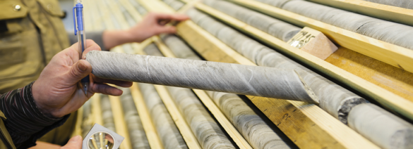
Kallioperästä kairauslaitteistolla kairattuja kiinteitä kivinäytteitä, joita on otettu malminetsinnän, kalliorakentamisen ja muun kallioperätutkimuksen tarpeisiin. Arkistoituja kairasydämiä voi tutkia Lopella tutkimustiloissa. Tutkimuskäynneistä veloitetaan laite-, työvoima- ja yöpymiskulut hinnaston mukaan. Näytteenotto on mahdollista ehtojen puitteissa.
Lisätietoa kairasydämistä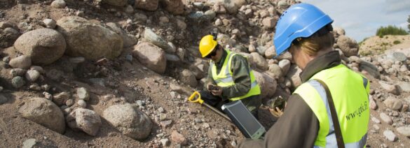
Näytteet on otettu muuttumattomasta moreenista (C-horisontti) pohjavesipinnan alta noin 1,5–2 m syvyydeltä. Näytteet ovat kenttäyhdistelmänäytteitä ja ne on lähtökohtaisesti tarkoitettu moreeniaineksen kemiallisten ominaisuuksien määrittämiseksi malminetsinnän ja ympäristötutkimuksen tarpeisiin.
Lisätietoa moreenigeokemian näytteistä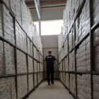
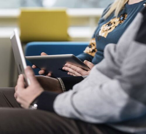
GTK:n verkkokirjasto ja Summon ovat kaikille avoimia ja palvelevat kaikkia geoalasta kiinnostuneita. Lainaaminen on mahdollista rekisteröityneelle asiakkaalle. Pääset rekisteröitymään käymällä paikan päällä GTK:n kirjastossa tai luomalla käyttäjätunnuksen verkossa.
Siirry verkkokirjastoon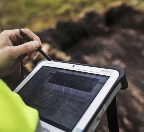
GTK:n kirjasto on julkinen kirjasto, joka palvelee kaikkia geologisen tiedon tarvitsijoita. Kirjastossamme on Suomen laajimmat geoalan kokoelmat. Verkkokirjastosta löydät mm. tiedot kirjaston tuottamista palveluista, lainausohjeet, käytettävissä olevat tietokannat, verkkolähteet, sanastot, yhteystiedot. Voit myös tehdä hakuja, varata aineistoa, uusia lainojasi, tehdä tietopalvelupyyntöjä ja kysyä ohjeita.
Summonista löydät kaiken kirjastoissamme käytössä olevan kirjallisen aineiston, kuten tilaamamme e-lehdet, niiden kokotekstiartikkelit, e-kirjat sekä kaikki kirjastojärjestelmässämme olevan aineiston. Tällä hetkellä tietueita on yli 50 miljoonaa. Maksullisiin e-lehtiin tai e-kirjoihin on pääsy vain GTK:n verkossa olevilta laitteilta. Haku, saatavuus- ja viitetiedot, abstraktit, kevyt altmetriikkanäkymä sekä open access -julkaisut ovat kuitenkin kaikkien käytettävissä ja voit laajentaa hakuasi myös kirjastokokoelmamme ulkopuoliseen aineistoon.
Aineistot ja paikkatietotietotuotteet ovat pitkälti GTK:n omistamia ja niiden käyttöön liittyy ehtoja ja käytäntöjä. Alla olevista pdf-tiedostoista voit kätevästi tarkistaa, missä raameissa voit hyödyntää GTK:n aineistoja.
Tomi Rönkkö
Yksikön päällikkö, Tietoratkaisut
tomi.ronkko@gtk.fi
029 503 3279